Property
Property
Description
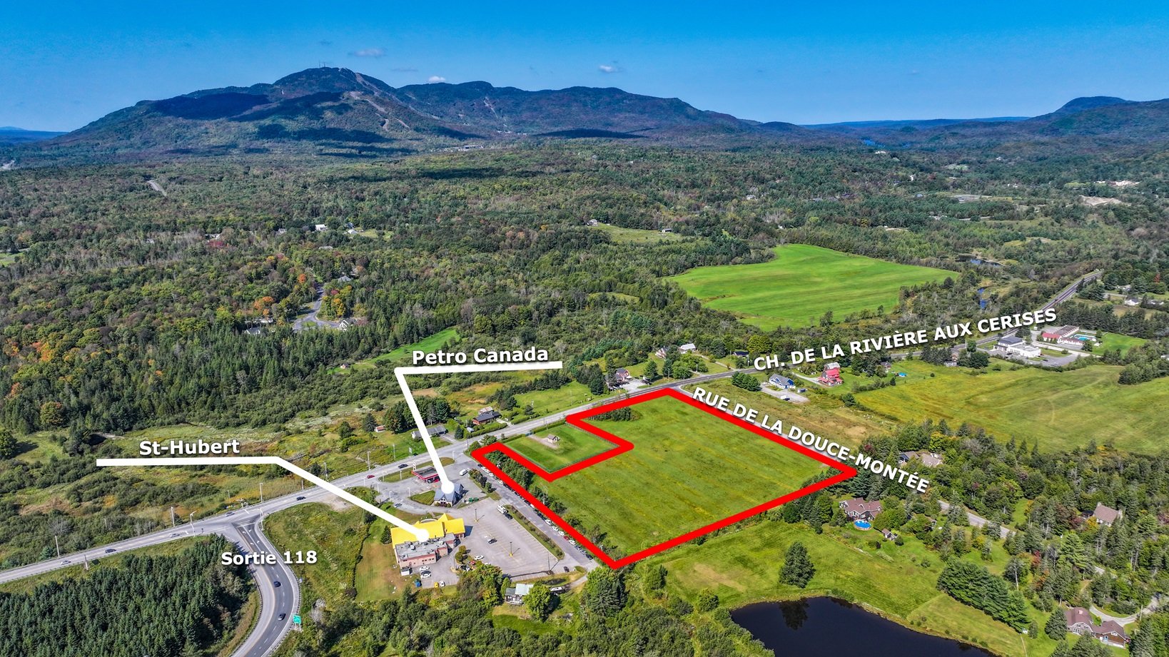
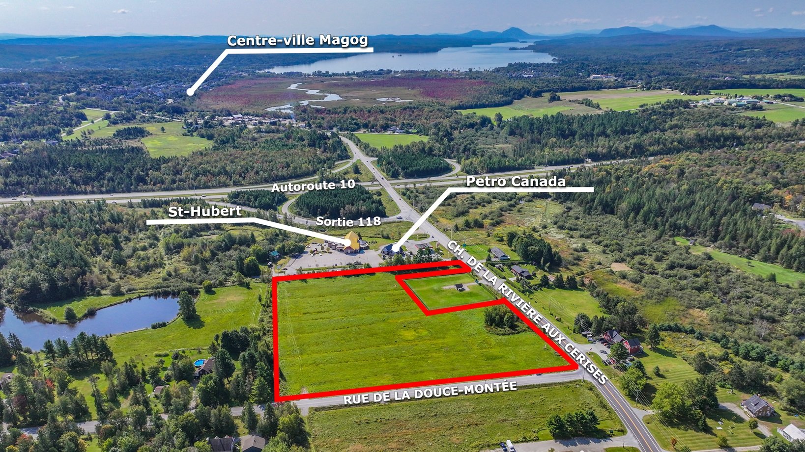
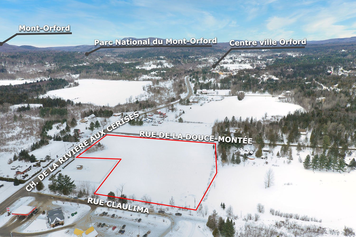
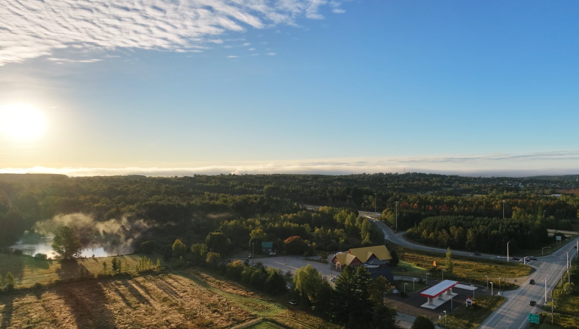
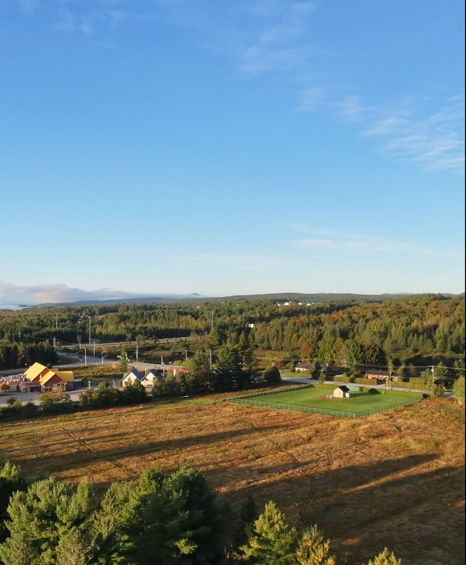
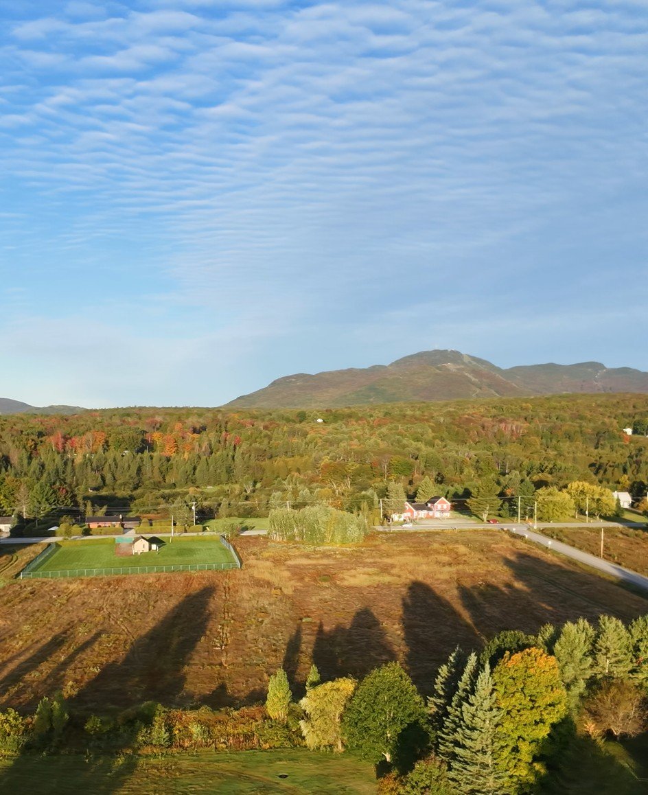
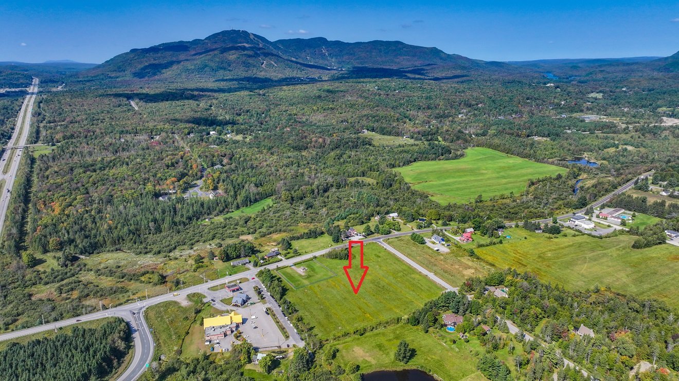
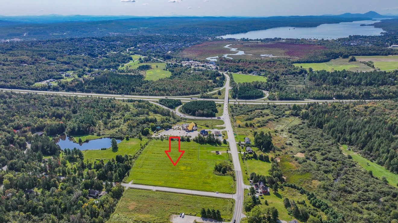
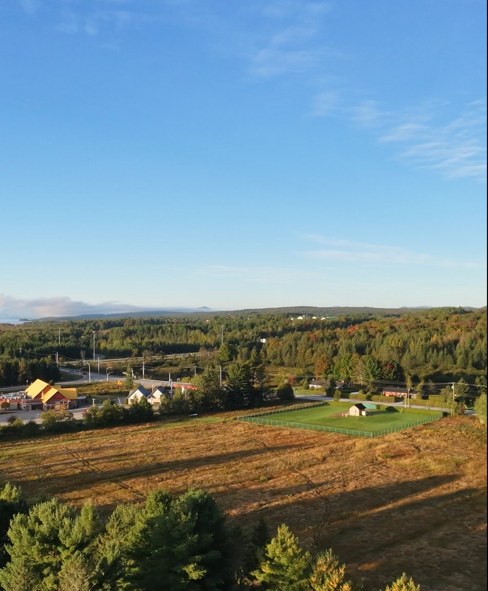
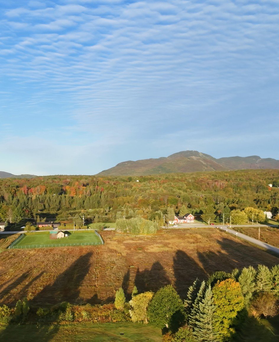
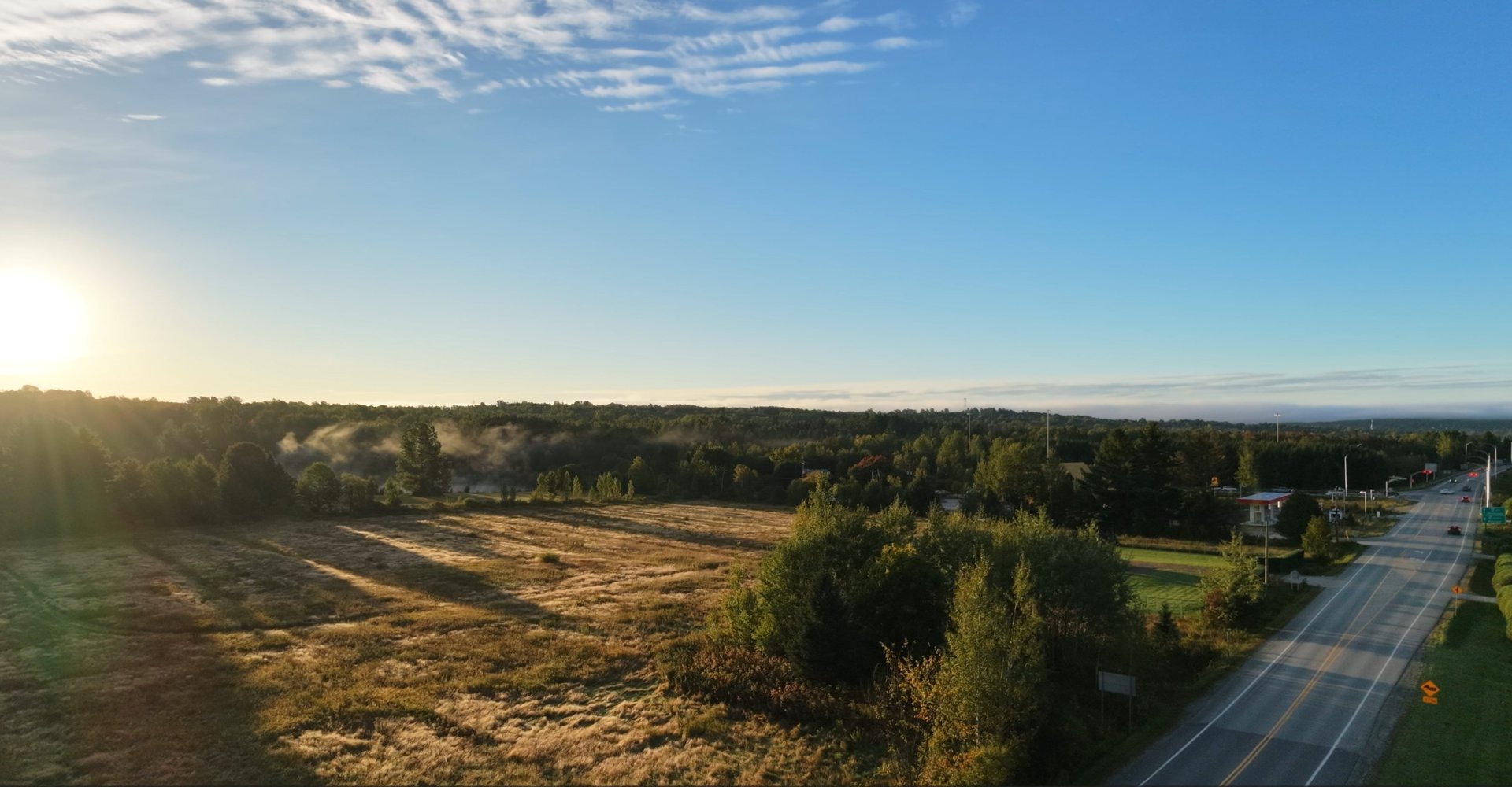
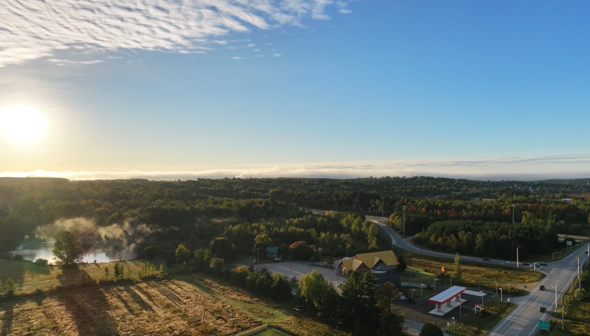
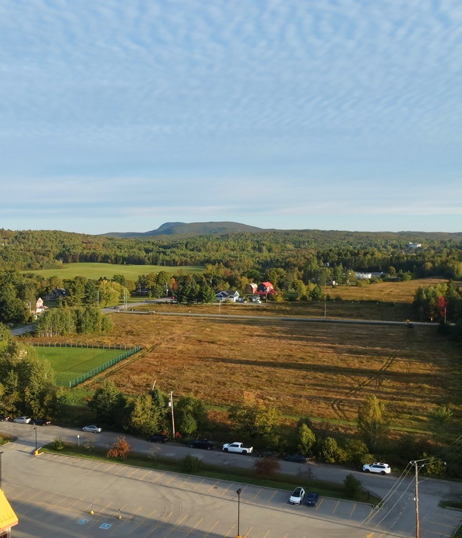
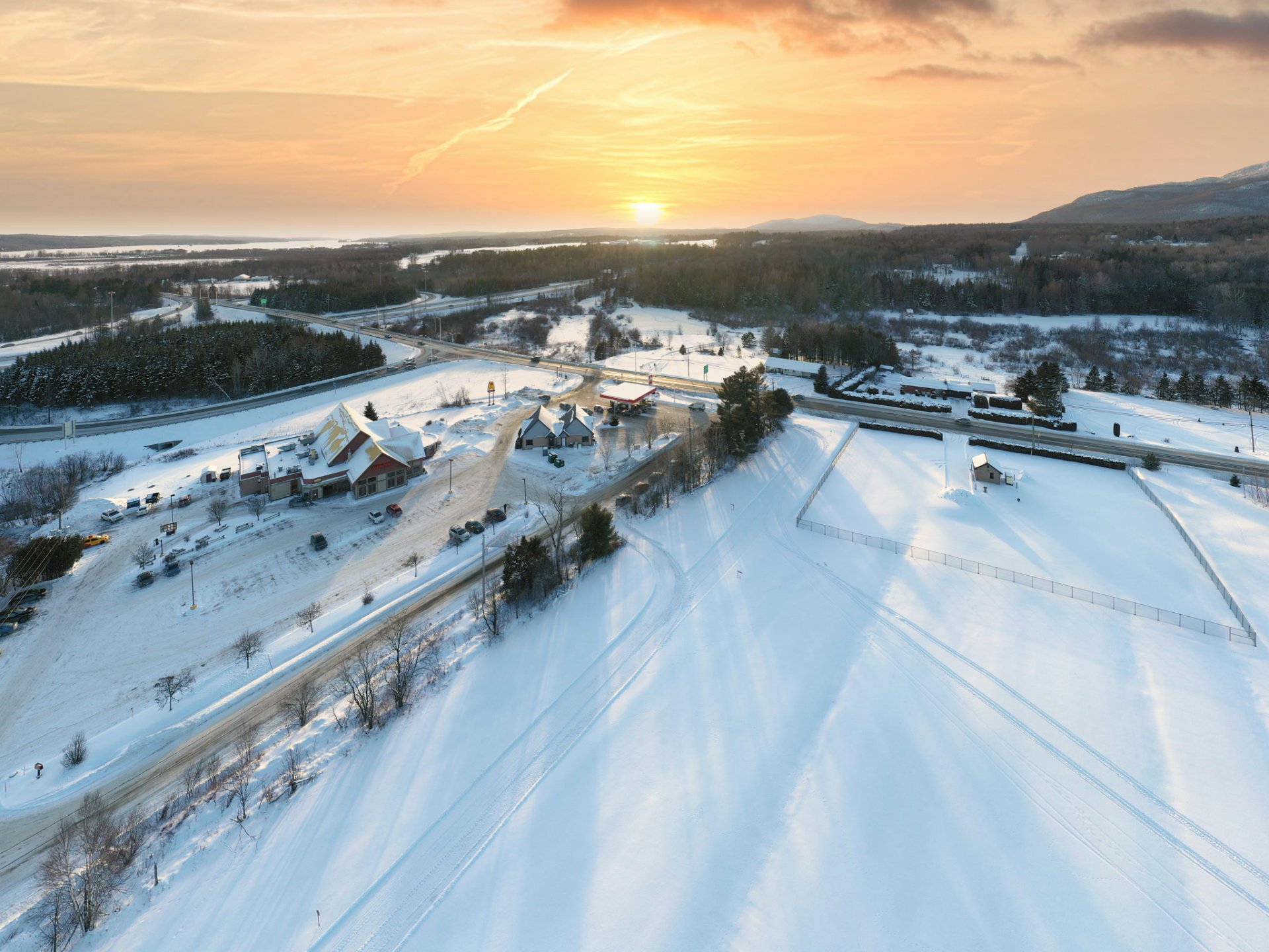
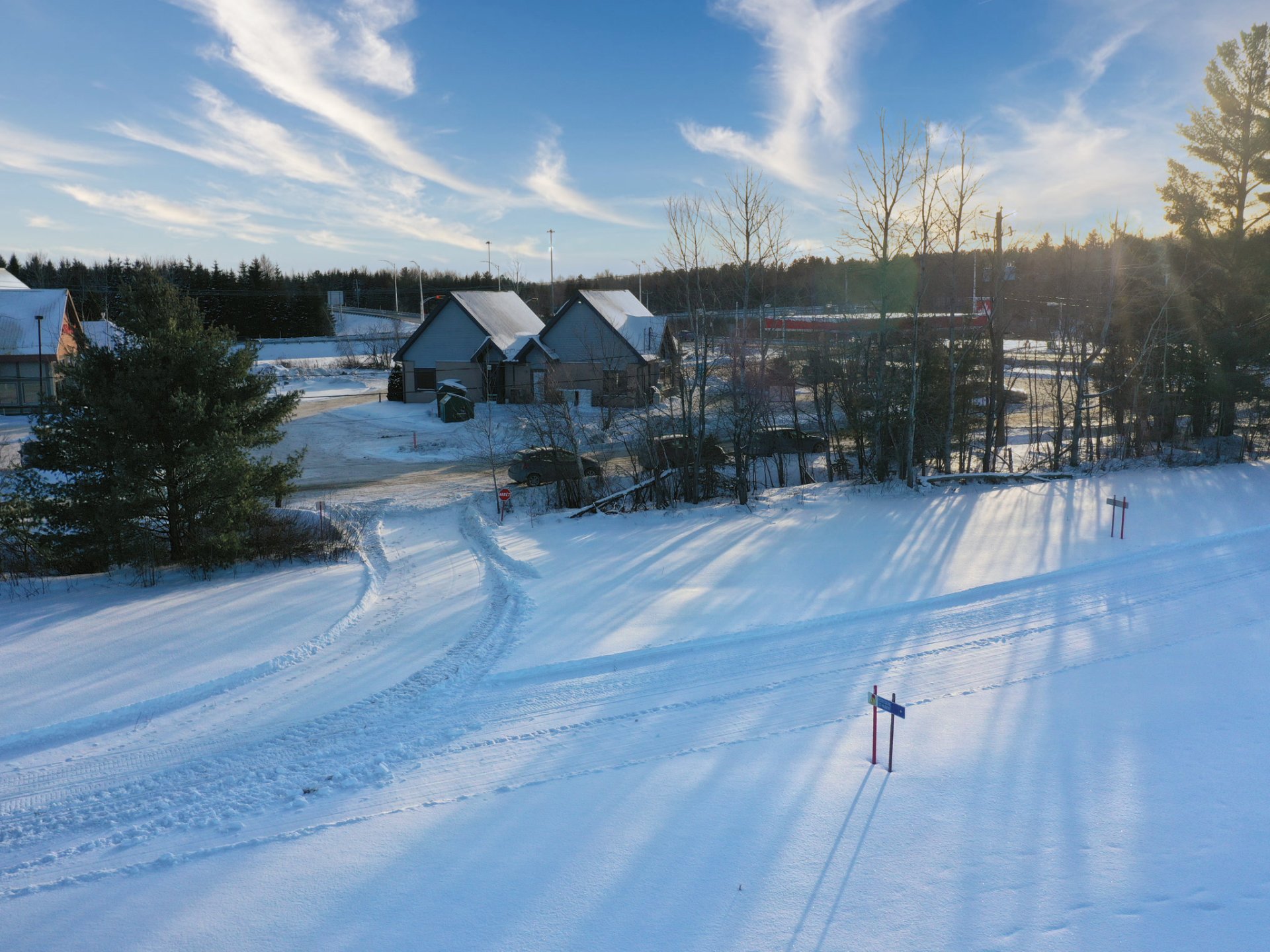
311,607 SQ.FT. COMMERCIAL LAND AT EXIT 118 OF HIGHWAY 10. Zone C202 allows a DRIVE-THROUGH RESTAURANT. The first site capturing tourist traffic heading to Mont-Orford National Park. Flat, single parcel, corner lot, next to St-Hubert, Petro-Canada and Boni-Soir. Also permitted: spa, local products boutique, small inn. $3.69 per sq.ft. plus taxes. Full file available.
COMMERCIAL LAND READY TO DEVELOP Quartier du Marais · Magog, Eastern Townships
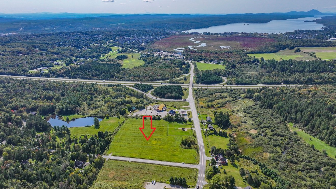
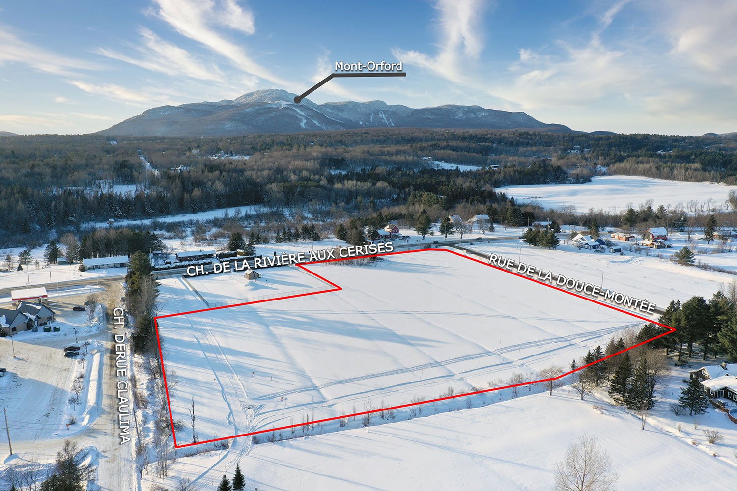
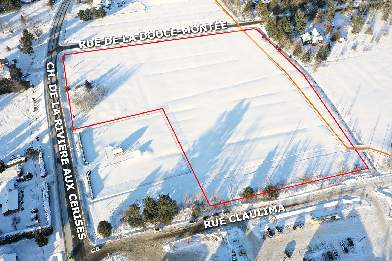
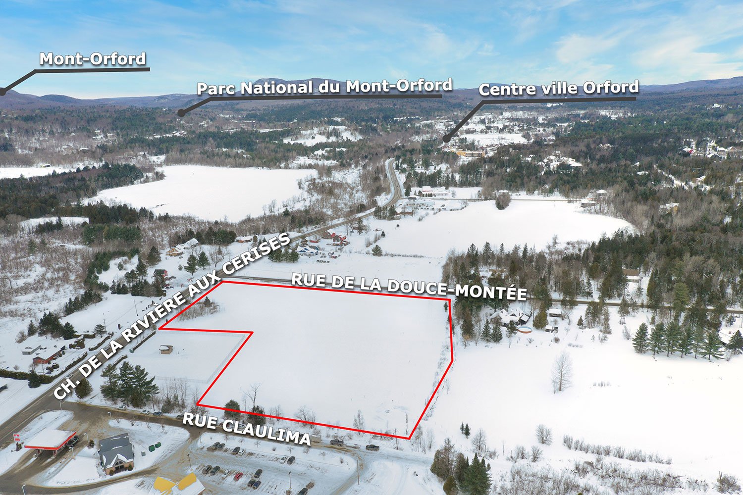
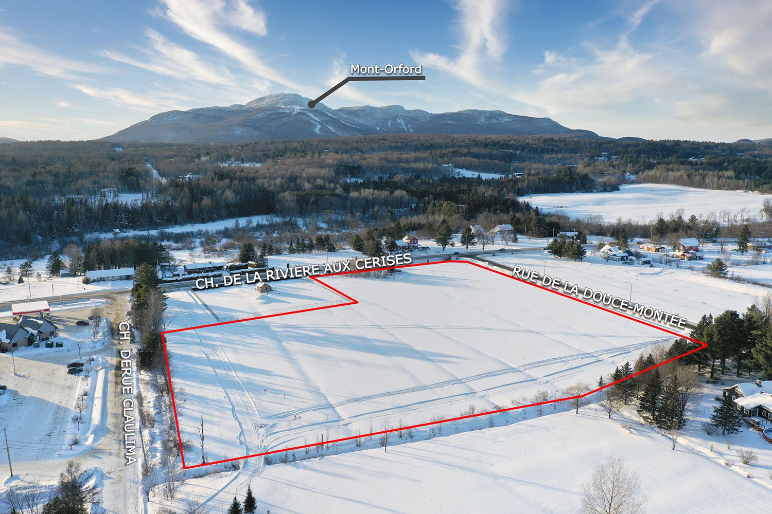
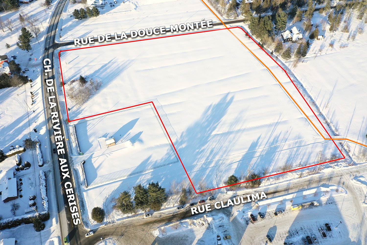
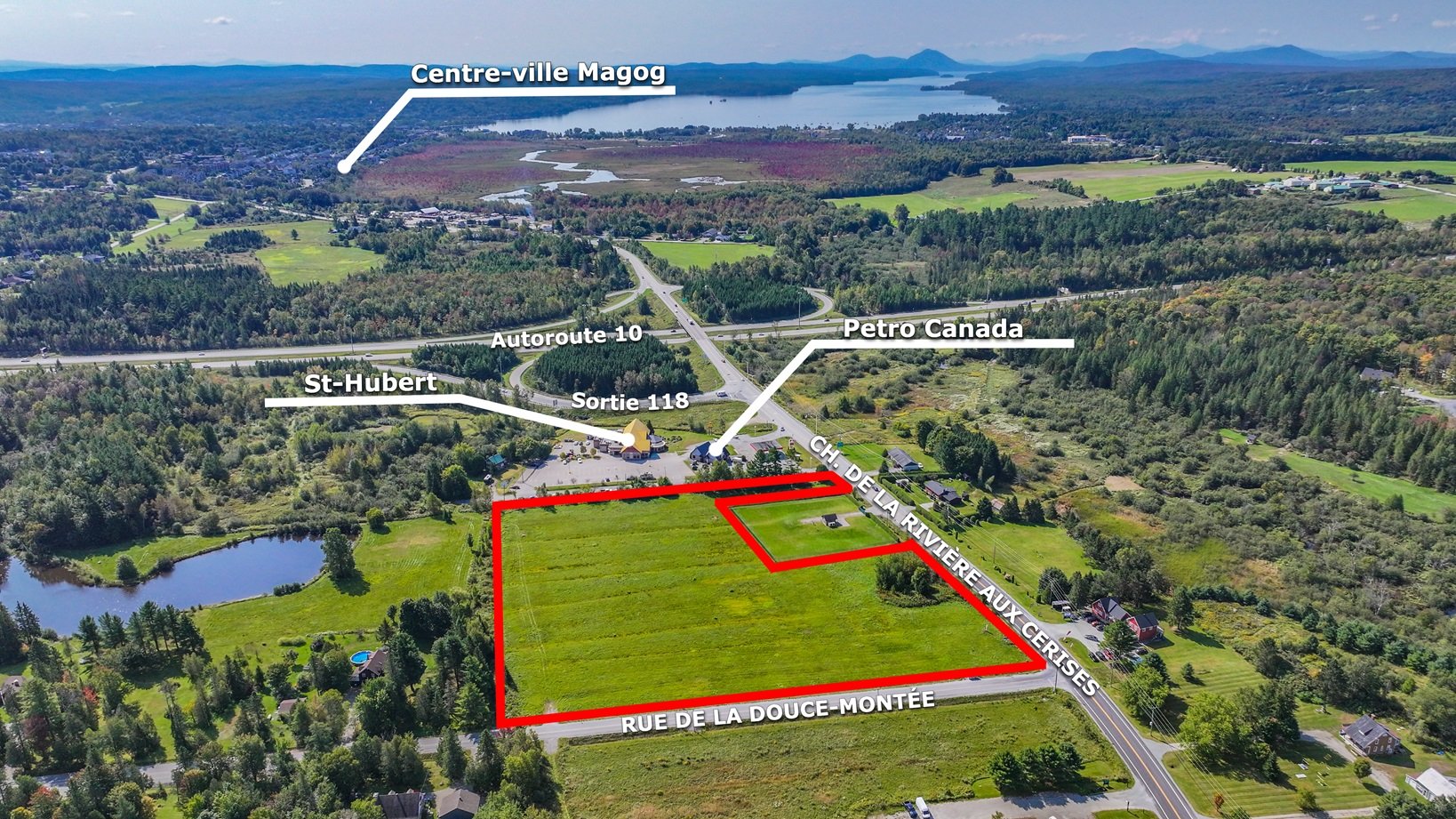
Strategic location at exit 118 of Highway 10, considered by the City of Magog as one of its main hubs. The land sits at the corner of chemin de la Rivière-aux-Cerises and rue de la Douce-Montée, on the corridor leading to Mont-Orford National Park, the ski resort and downtown Magog.
THE LAND 311,607 sq.ft. (28,949 sq.m., 7.15 acres), 605 x 599 ft, irregular shape Lot 6 197 942 of the Quebec cadastre Flat, single parcel, corner lot, no building Electricity along the road, no municipal water or sewer service Price: $1,150,000 + GST and QST, or $3.69 per square foot
TRAFFIC AND VISIBILITY 7,900 vehicles per day in front of the site on Route 141, up to 10,000 in summer (MTQ 2022). Close to 30,000 on Highway 10. Immediate neighbours: St-Hubert restaurant, Petro-Canada station with EV chargers, convenience store.
ZONING C202 (City of Magog by-law 3458-2024) Drive-through restaurant, no floor area limit Microbrewery or brewpub with craft production on site Bakery, cheese shop and food processing with retail sale and tasting Local products, gifts and souvenirs boutique, up to 300 sq.m per establishment Art gallery, artist studio and production workshop Health centre with saunas, spas and therapeutic baths, indoor and outdoor, which may include a restaurant Rental of bicycles, skates and water equipment Tourist accommodation, hotel or tourist residence, up to 10 units Fuel station with convenience store and car wash, within a highway service centre Private parking lot Maximum height 12 m, lot coverage 30 %, minimum lot area 3,000 sq.m.
MARKET POTENTIAL 750,000 visitors per year at Mont-Orford National Park 6.5 million tourist overnight stays in the Memphrémagog RCM 54,797 residents, projected growth of +9.5 % by 2031 359 hotel rooms in three complexes along the same corridor Project specific market studies available
WHAT YOU SHOULD KNOW Servitude for a boundary ditch, surface water drainage and right of way. A wetland of interest and flood risk corridor is mapped along the Rivière aux Cerises; whether it encroaches on the lot remains to be confirmed with the City. Certificate of location dated 2016. Phase I environmental site assessment completed in 2023, available. A use not listed in the grid requires a by-law amendment or a specific project authorization from the City. The seller warrants no use and no right to build.
Sale with legal warranty. Full file provided on request.
Exclusions : None. The land is sold vacant, free of any occupancy and of any lease.
Location
Characteristics
| Proximity | Alpine skiing, ATV trail, Bicycle path, Cross-country skiing, Golf, Highway, Park - green area, Snowmobile trail |
|---|---|
| Zoning | Commercial, Recreational and tourism |
| Distinctive features | Environmental study phase 1, Street corner |
| Topography | Flat |
| View | Mountain, Panoramic |
| Water supply | None |
This property is presented in collaboration with EXP AGENCE IMMOBILIÈRE